Report 181 by G. H. Shafer, U.S. Geological Survey | March 1974, (reprinted November 1986)
- Report 181 - Ground-Water Resources of Duval County, Texas
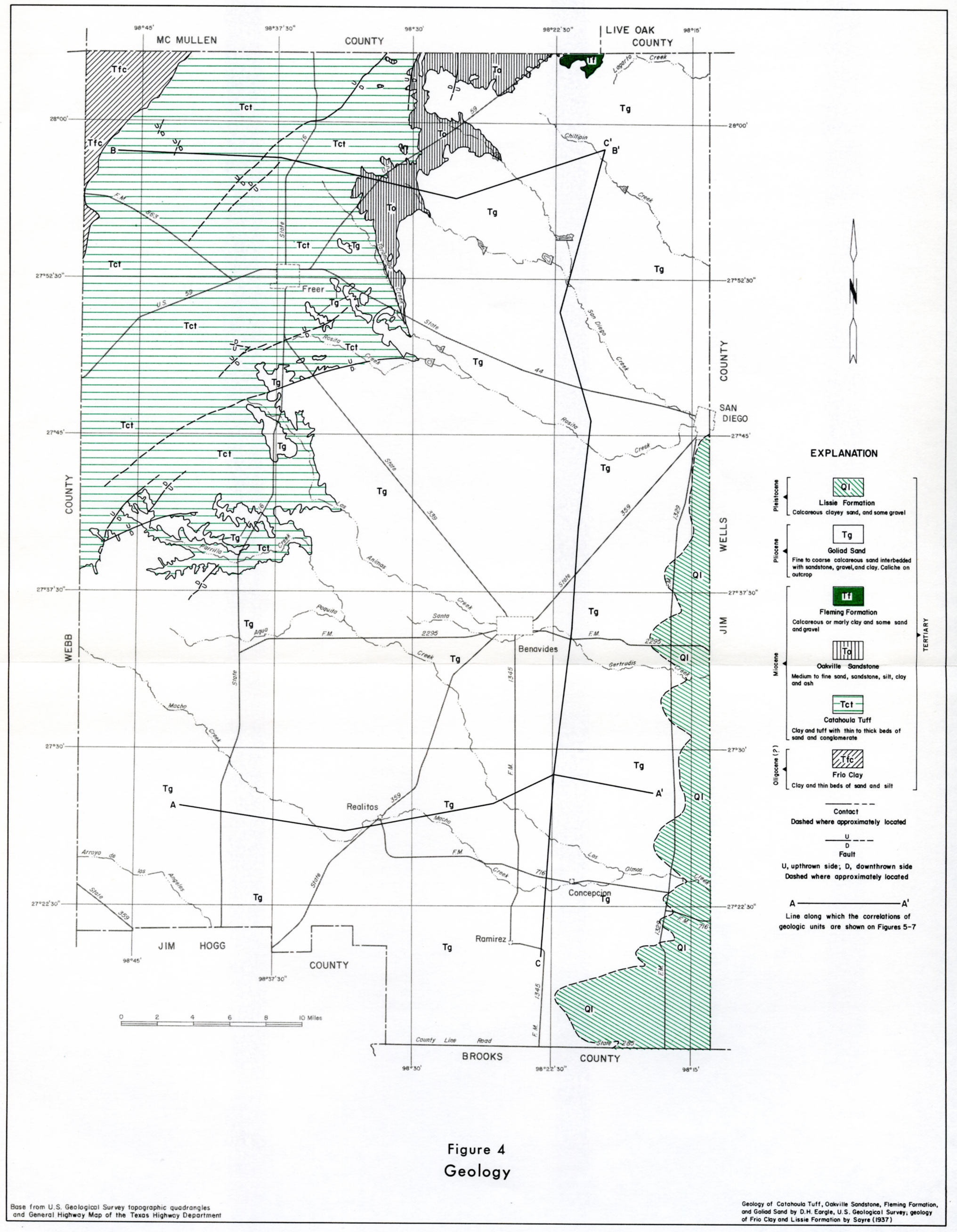
- Figure 4 - Geology
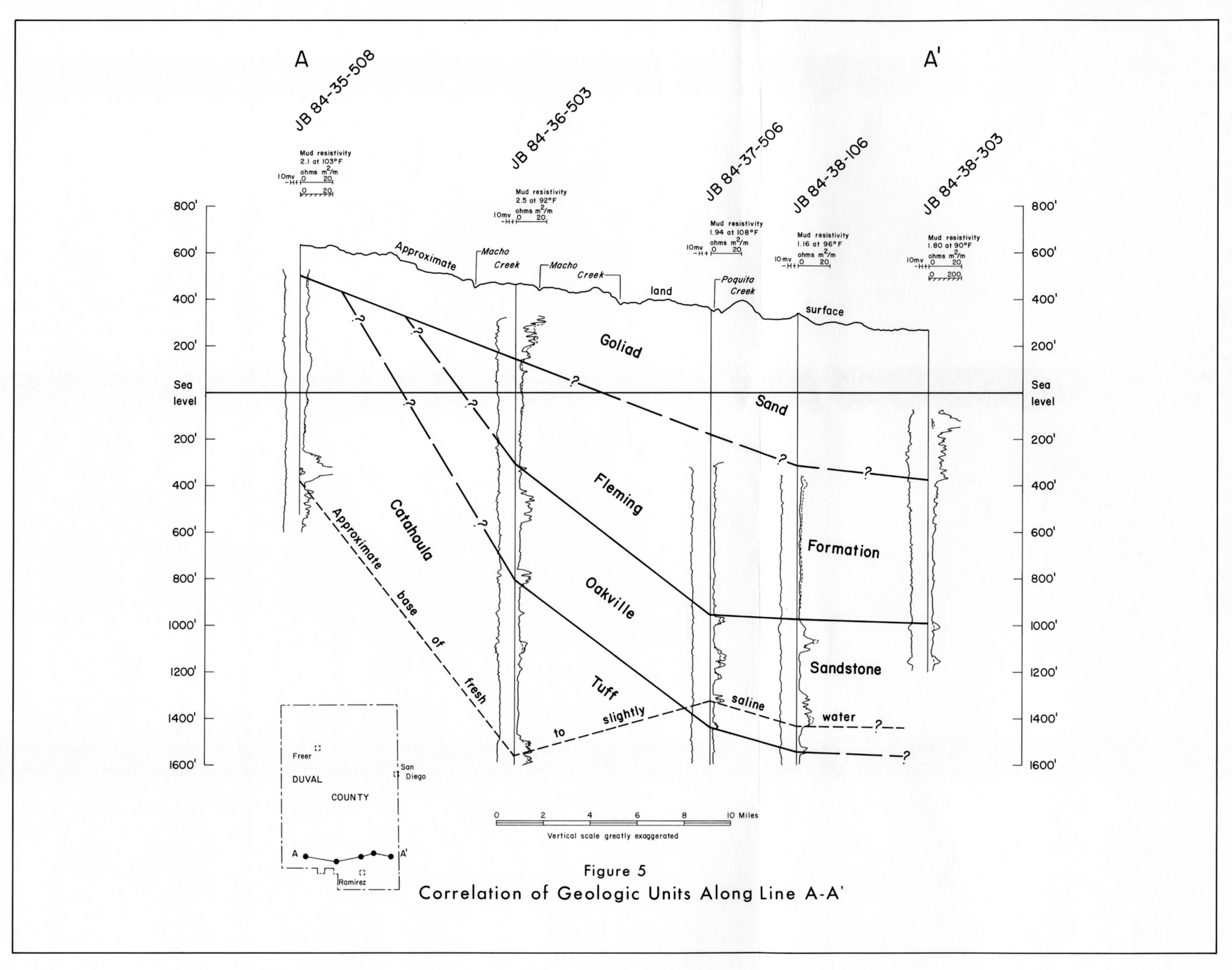
- Figure 5 - Correlation of Geologic Units Along Line A-A'
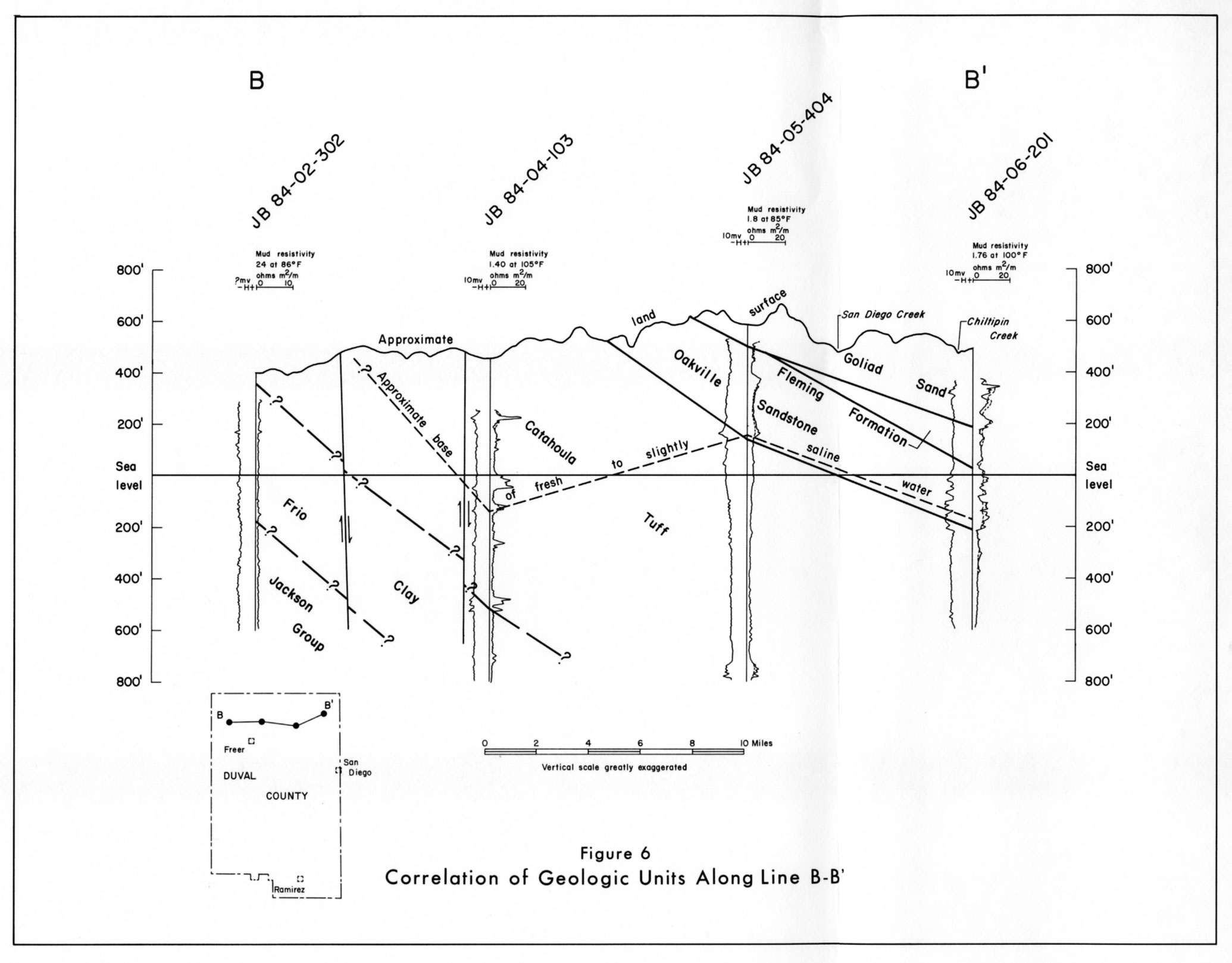
- Figure 6 - Correlation of Geologic Units Along Line B-B'
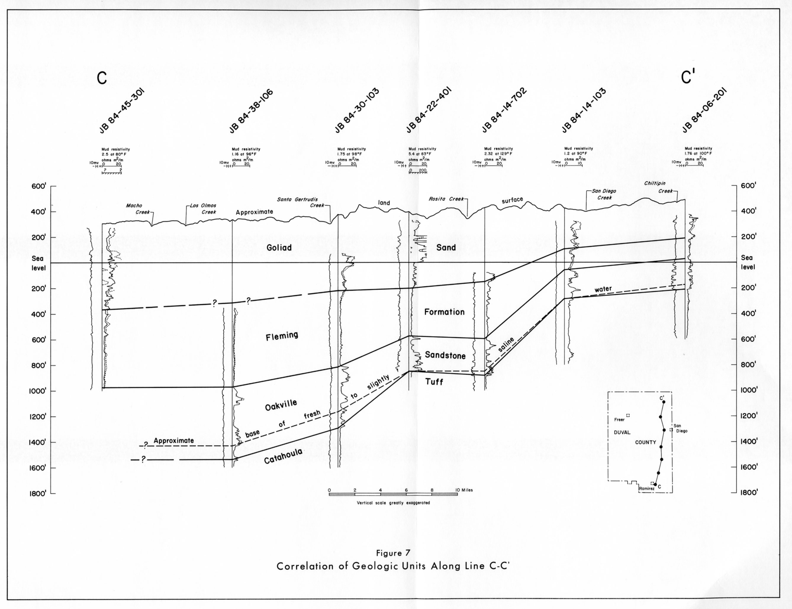
- Figure 7 - Correlation of Geologic Units Along Line C-C'
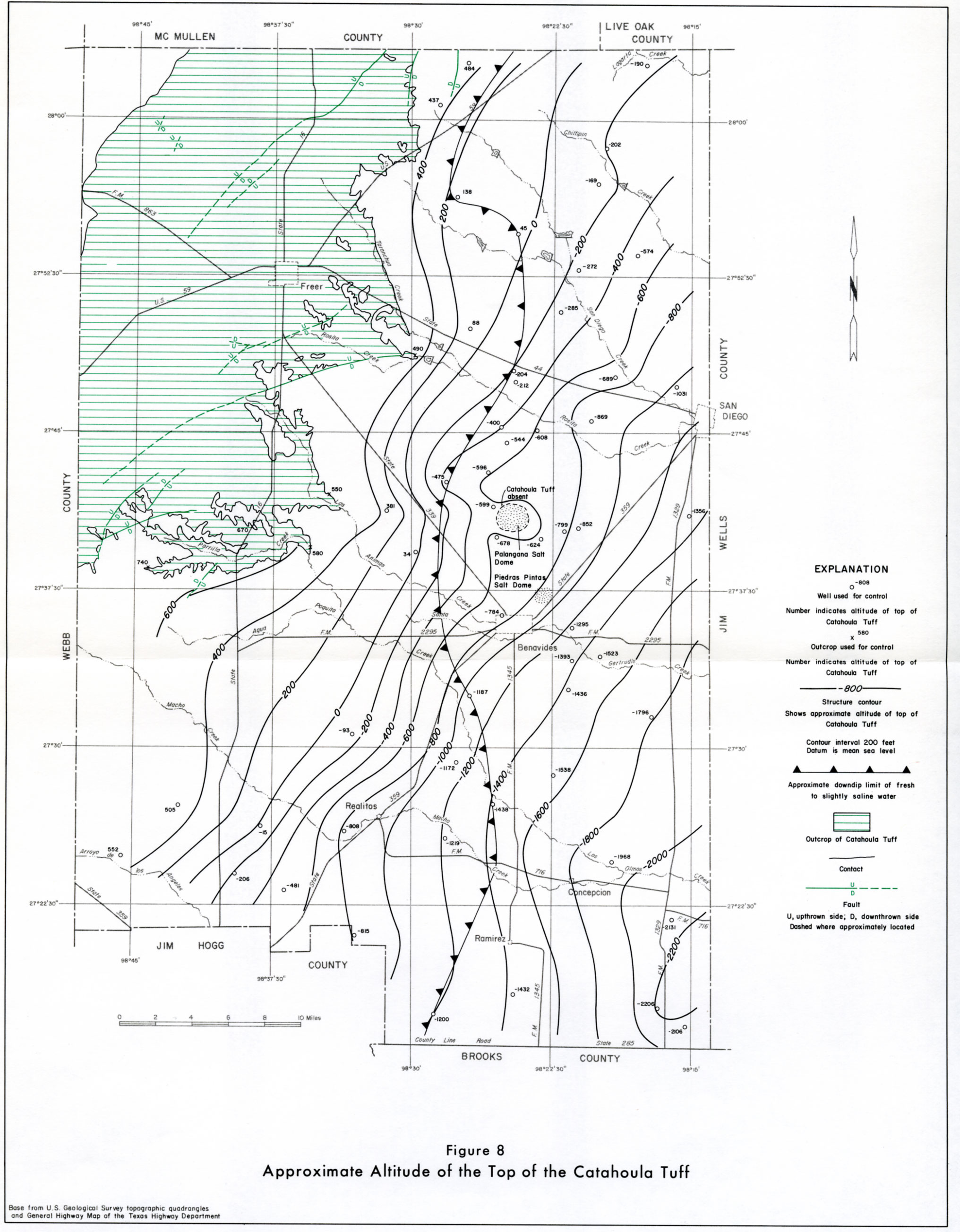
- Figure 8 - Approximate Altitude of the Top of the Catahoula Tuff
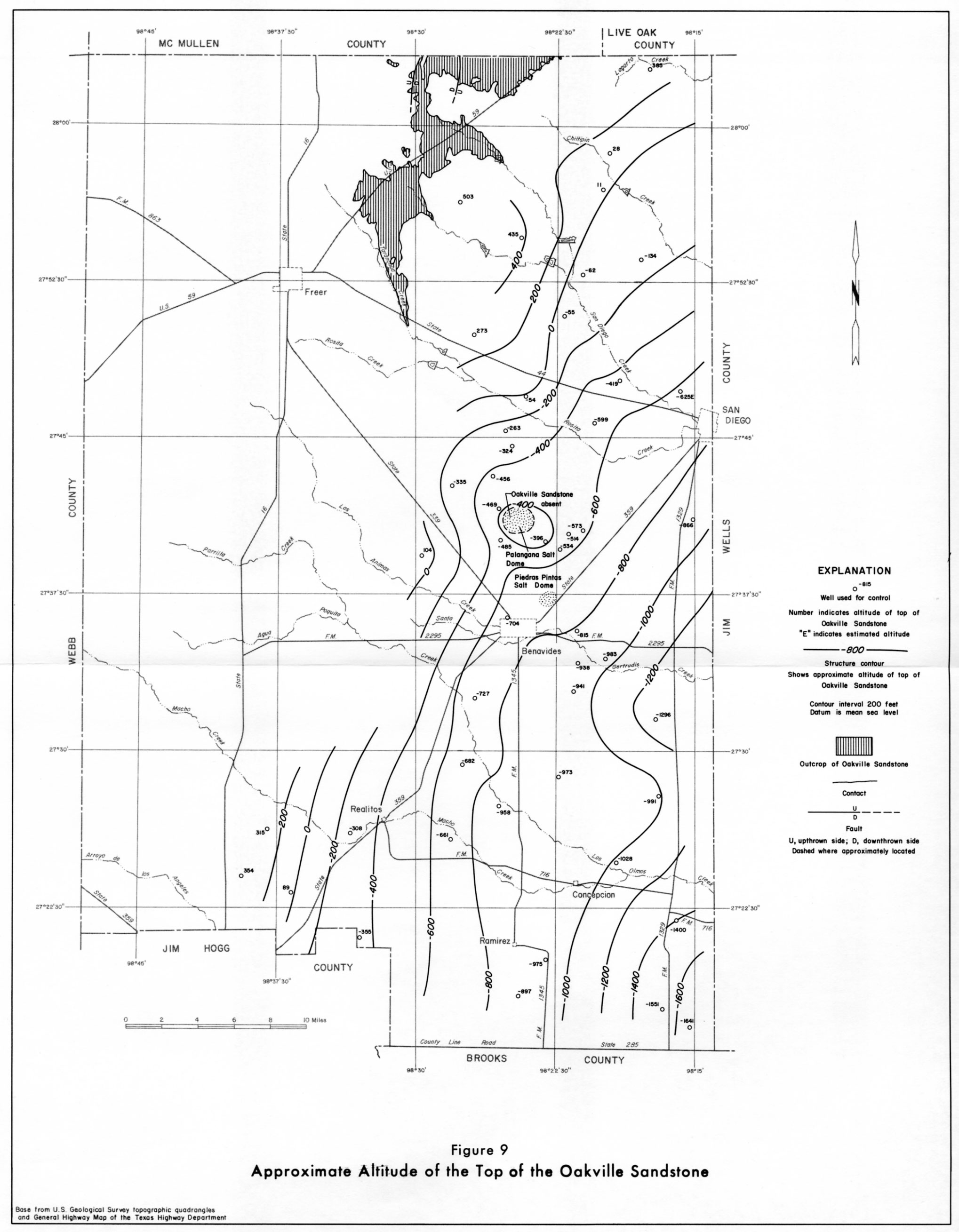
- Figure 9 - Approximate Altitude of the Top of the Oakville Sandstone
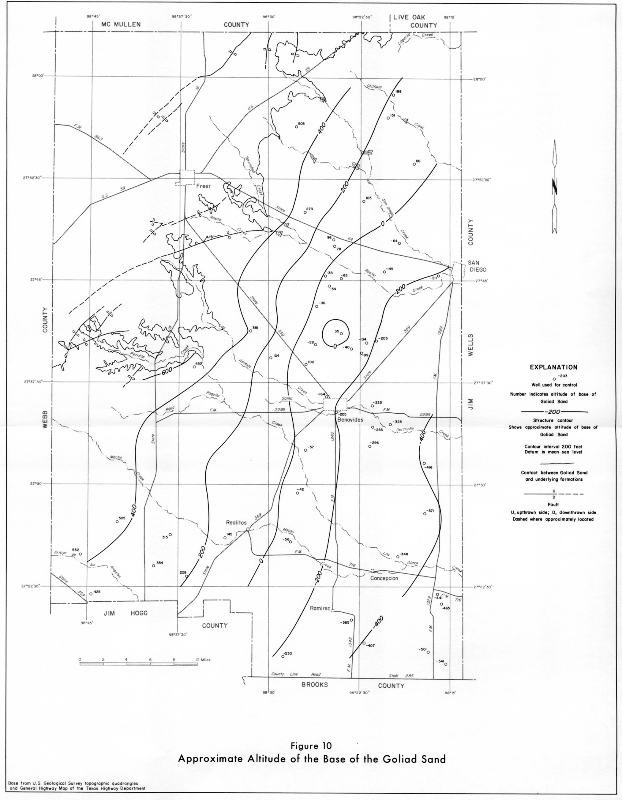
- Figure 10 - Approximate Altitude of the Base of the Goliad Sand
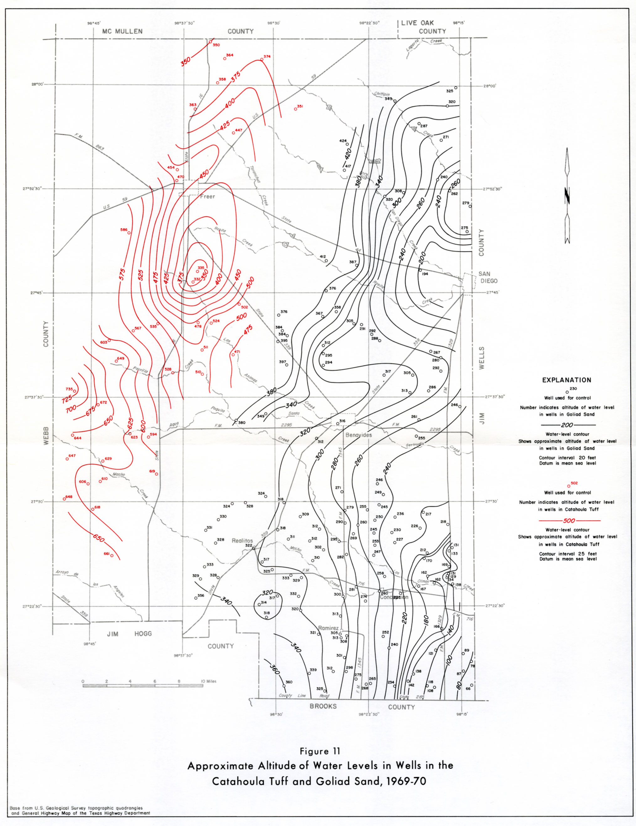
- Figure 11 - Approximate Altitude of Water Levels in Wells in the Catahoula Tuff and Goliad Sand, 1969-70
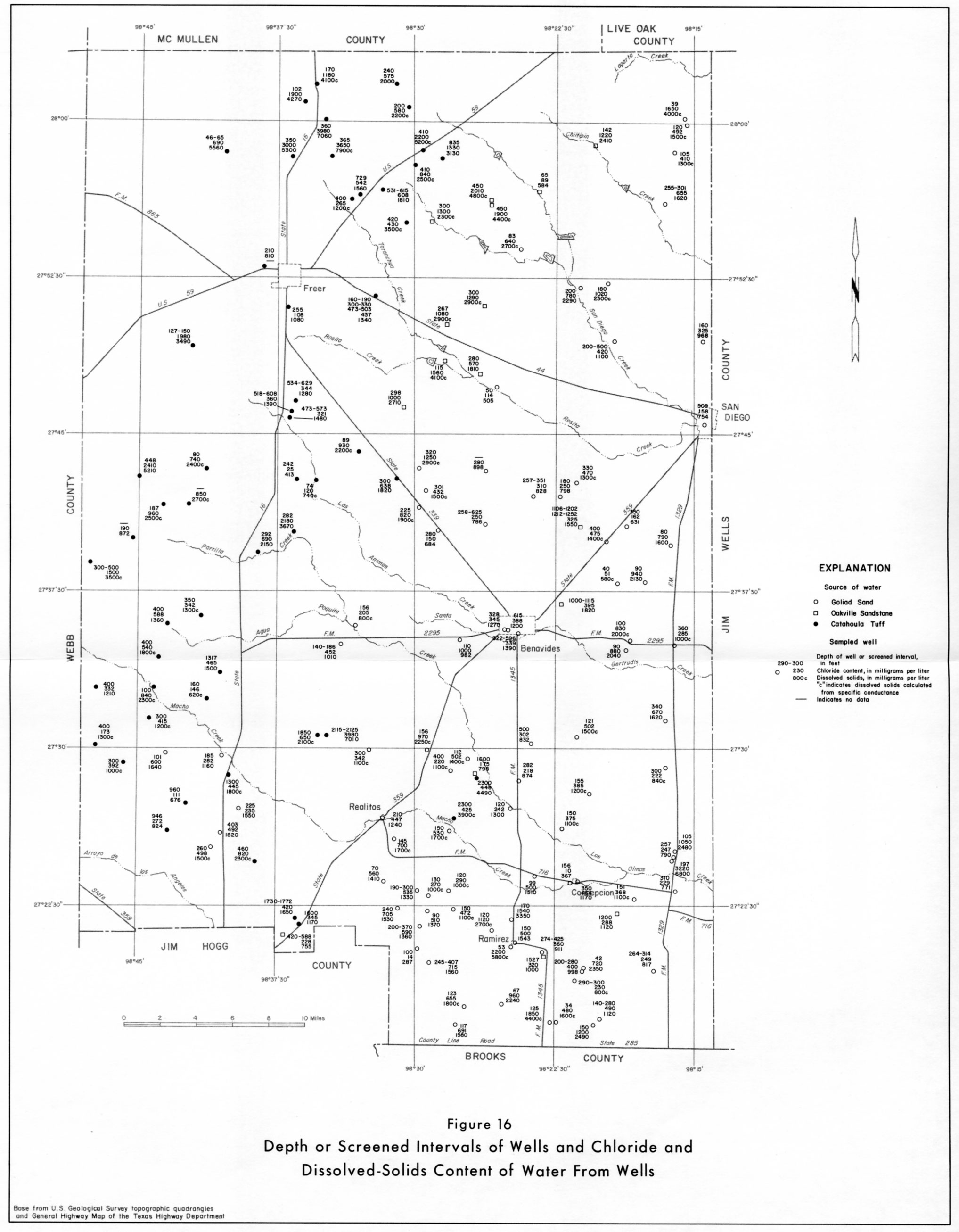
- Figure 16 - Depth or Screened Intervals of Wells and Chloride and Dissolved-Solids Content of Water From Wells
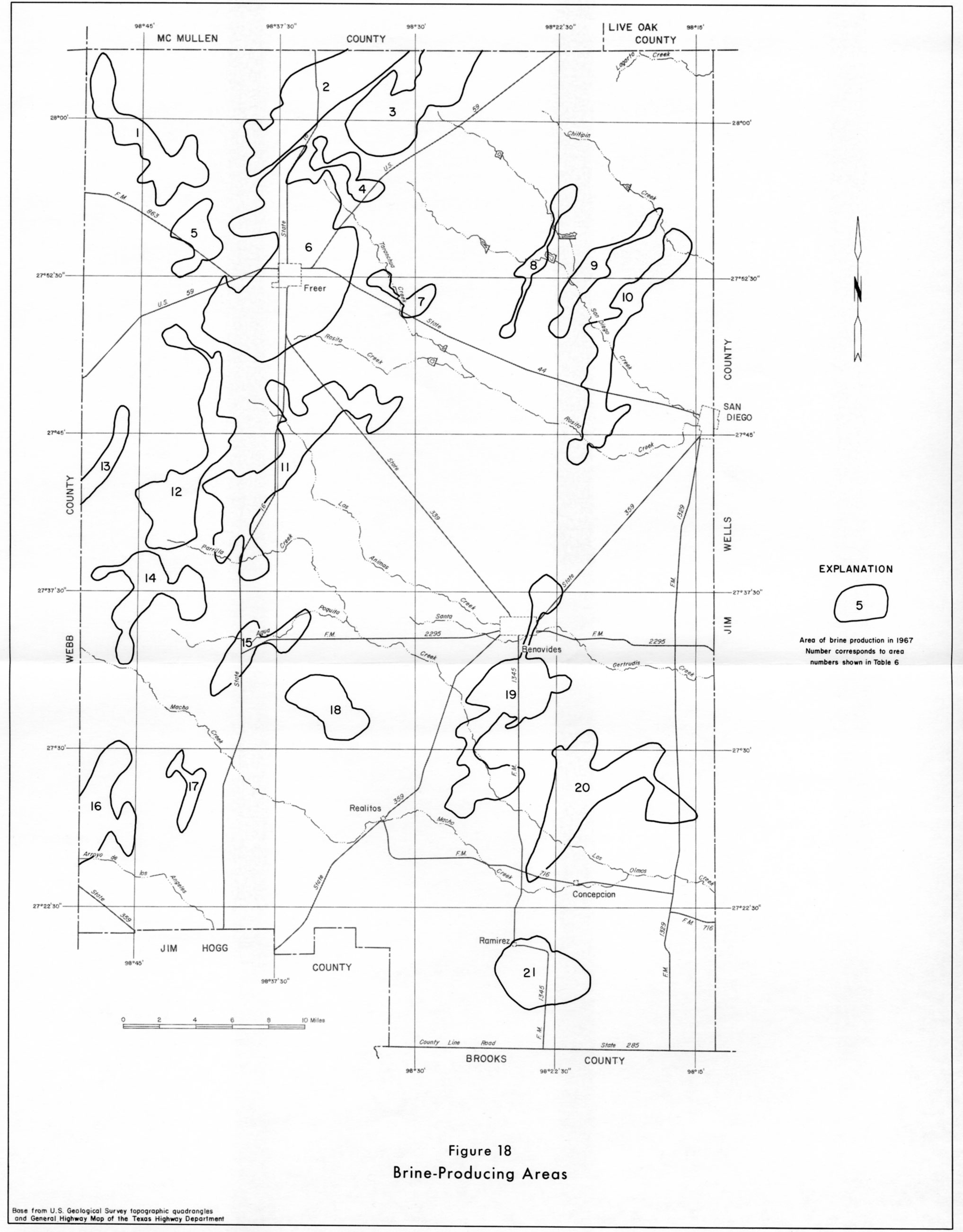
- Figure 18 - Brine-Producing Areas
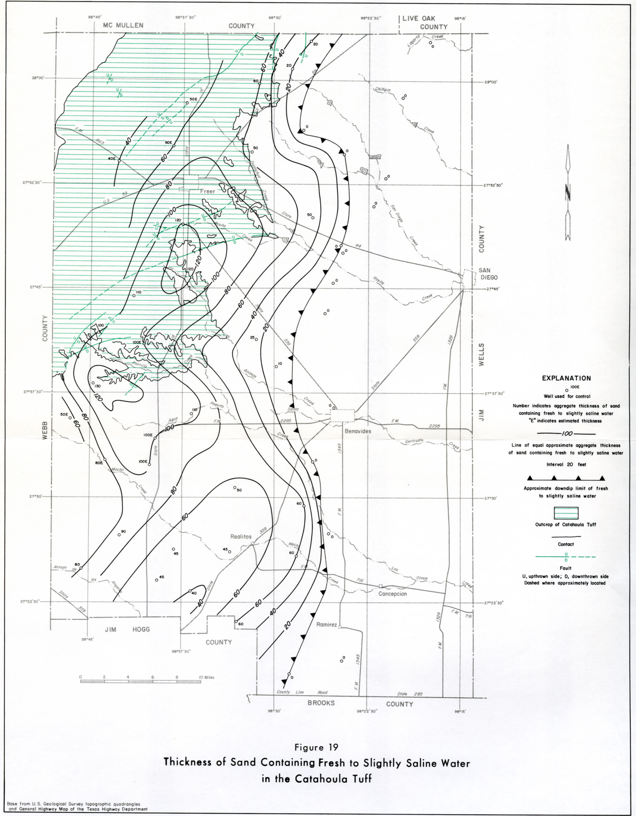
- Figure 19 - Thickness of Sand Containing Fresh to Slightly Saline Water in the Catahoula Tuff
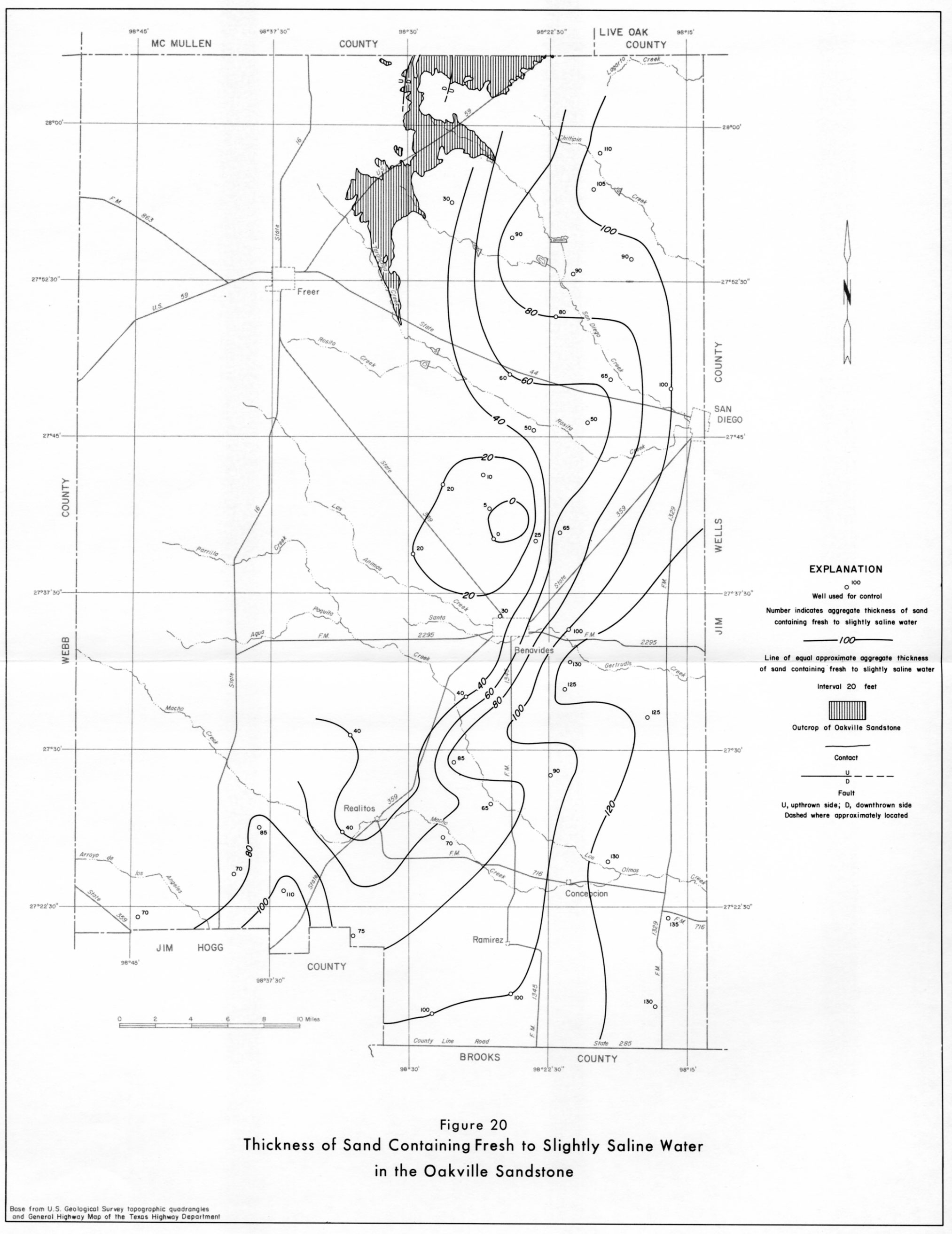
- Figure 20 - Thickness of Sand Containing Fresh to Slightly Saline Water in the Oakville Sandstone
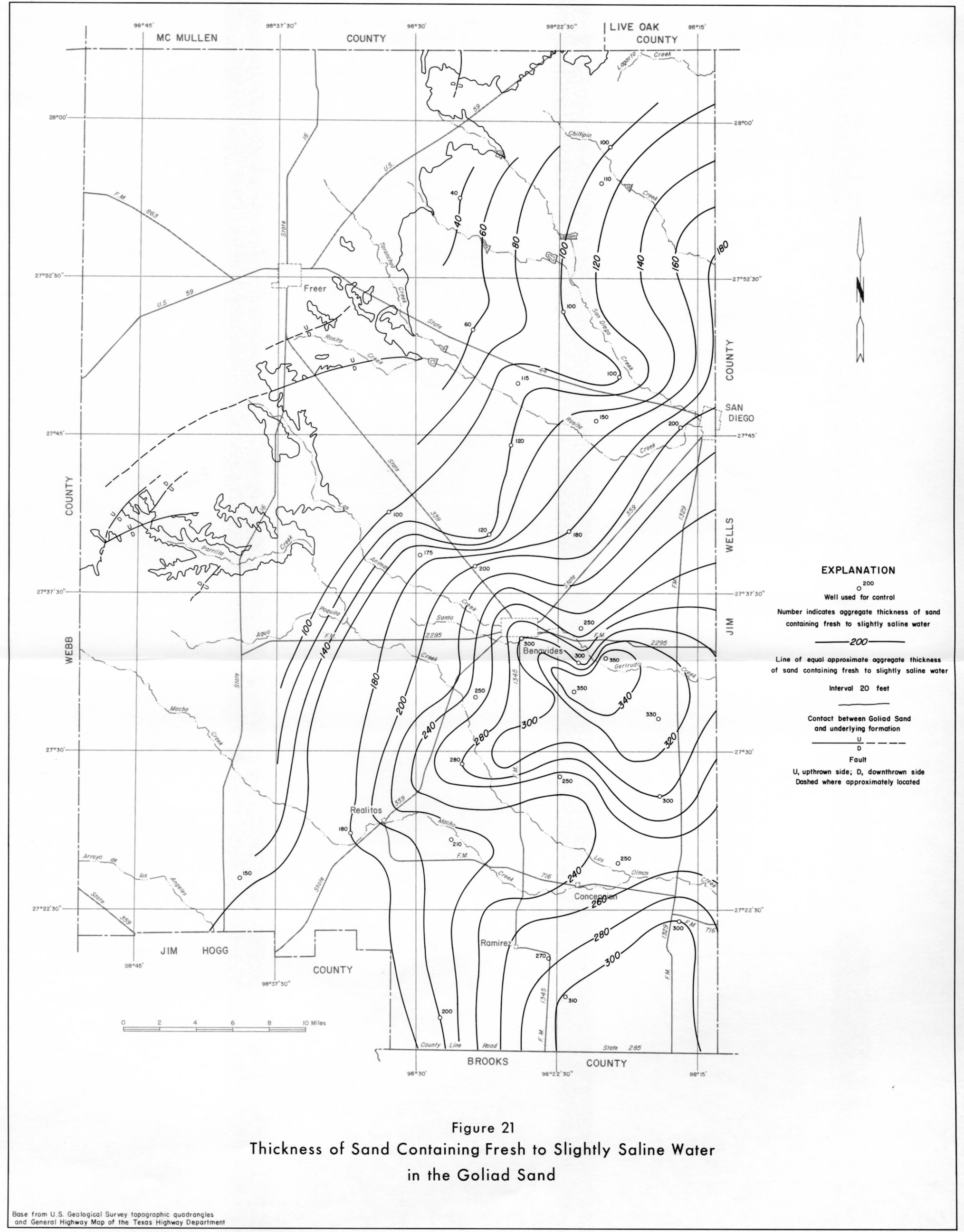
- Figure 21 - Thickness of Sand Containing Fresh to Slightly Saline Water in the Goliad Sand
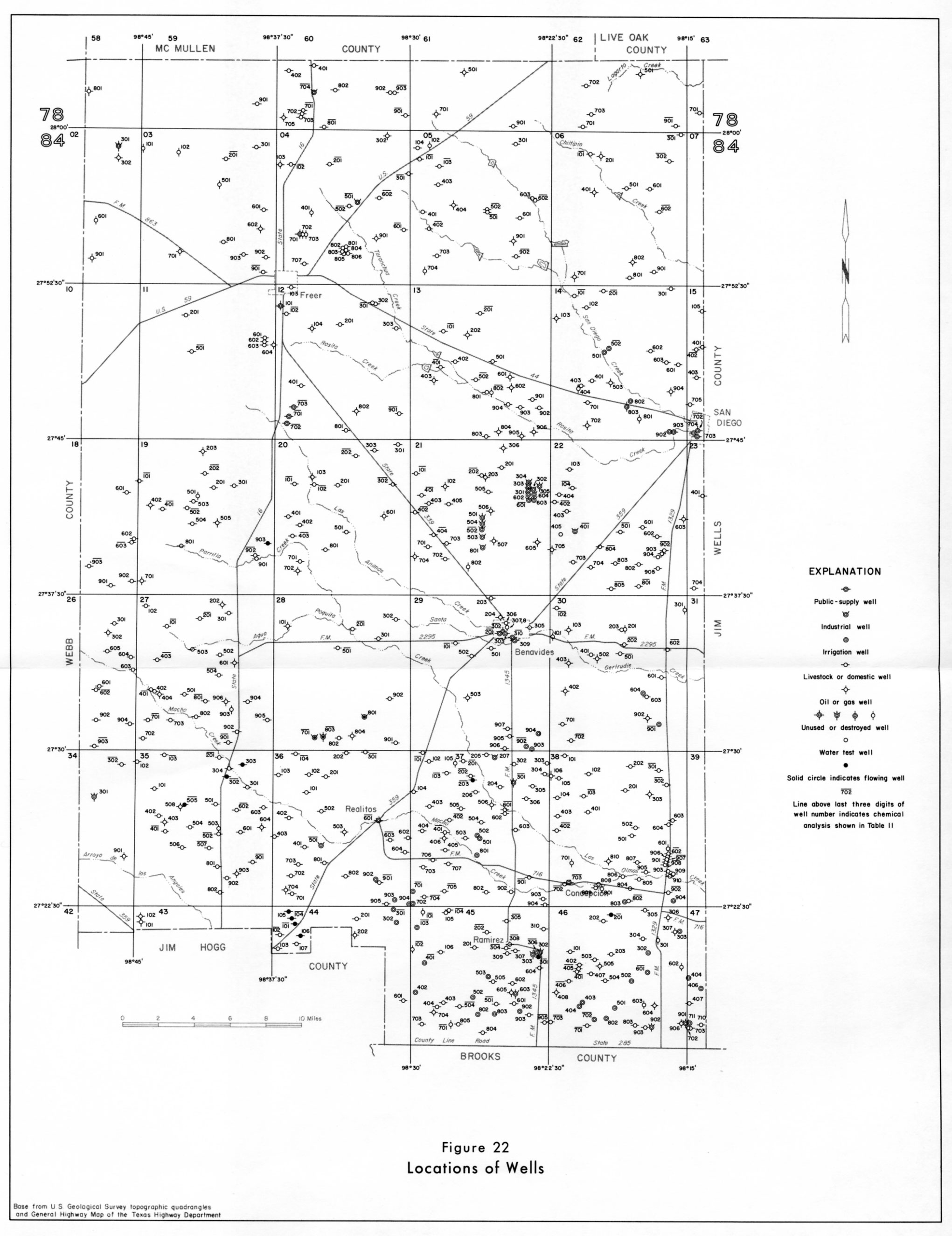
- Figure 22 - Locations of Wells